
Camino Guide Reviews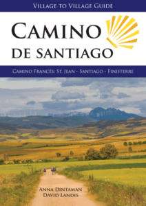
Read 250+ reviews on Amazon.com
A Beautiful New Alternative – R. Gilbert (Amazon.com)
I may be one of the first people to use this new book, because it was released just days before my wife and I started our own Camino. We did the first 11 days of the Camino de Santiago starting in Saint-Jean-Pied-de-Port, France, and ending in Nájera, Spain. We’ll continue from there next year. I liked this book so much that I decided to take it with us as our only guide book, and I was glad I did.
First impression: it’s beautiful! Stunning photos, great maps, and directions that make sense. I especially like the detailed list of albergues in each town, complete with prices and icons showing their amenities. The book covers the entire route all the way to Finisterre and Muxia, with daily stages of around 25km (15.5mi) per day. You can, of course, finish your day anywhere you like, but the stages often end in the larger towns with more options for places to stay and eat, as well as resources such as pharmacies, ATM machines, etc.
Each stage begins with an overview including the distance, difficulty, average number of hours, and a breakdown of the percentage of time you’ll spend on paved vs. unpaved pathways. It then includes a description of what you’ll be facing that day, along with an elevation chart and a map showing all towns and the amenities you can expect to find there (albergues, food, shopping, etc.) It then walks you through each town you’ll be visiting, and describes points of interest as well as warnings for things to watch out for (like the lack of water between Valcarlos and Roncesvalles). Each town has a sidebar with a listing of places to stay, each with its price, contact details, and amenities (food, washer, dryer, kitchen, WiFi, number of beds, etc.) Maps are also included for the larger towns, with all places to stay marked on the map. We always found it easy to understand the differences between the albergues, and to find them once we arrived in the town.
The book also includes a lot of nice information in the introductory chapters, including a history of the Camino, when to go, how to get there, visas, the various types of places to stay and eat, costs, safety issues, packing lists, and lots more. This information is expanded even further on the book’s extensive web site, including links to many of the sites and places to stay that are listed in each stage.
Since many people seem to be using John Brierley’s book, A Pilgrim’s Guide to the Camino de Santiago, I’ll make a few quick comparisons.
The distances between places are different than in the Brierley book. This book resets the distance to zero at the beginning of each stage, and then shows the cumulative distance until the end of the stage. 0.0, 3.2, 6.8, 12.0, 18.5, etc. Whereas Brierley shows the distance from place to place and not the cumulative distance. 0.0, 3.3, 1.5, 2.7, etc. I like this book’s way better, at least if your stages mostly line up with the book’s. If you end up staying at a town that’s not at the beginning of a stage though, your numbers will be off a bit the next day. That happened to us occasionally, but it wasn’t a big problem.
This book is 2.8 cubic inches (46 cu cm) larger and 3.4 ounces (96 g) heavier than Brierley’s. Partly because it includes Finisterre and Muxia, but mostly because the general tone of the writing is much more relaxed and less terse, with larger pictures. Although it’s a bit wider than Brierley’s, I had no problem carrying it in a side pocket of my pants so it was always available. And since we were only doing the first 11 days, I removed the last two thirds of the pages to cut down on weight — the authors suggest doing exactly that actually, for pages you’ve already used along the way. I carefully compared the directions for the multiple paths leading into Burgos, and both books cover all the details about equally well — I feel certain I could find my way with either one. But there’s no question that I prefer the tone of this one.
One of the best items on the book’s web site is a downloadable GPS track of the entire Camino, including alternate pathways. I imported the data into the fantastic “GPS Kit” iPhone app and then cached the maps near the paths. I was then always able to see at a glance where we were in relation to the marked pathway, as well as the distance and direction to any point on the map — all without a data connection.
Overall I was quite happy with our time with this book on the Camino, and I’ll be taking it next year when we continue. I definitely recommend it.
Best Camino Frances Guidebook in English! – Renegadepilgrim (Amazon.com)
There’s a new kid on the block and I’m excited to share this new resource for pilgrims planning to walk the Camino de Santiago in Spain. In the past, guidebooks in English have been limited to two options. Neither are perfect and to be honest, I’ve yet to find a guidebook for anything travel-related that meets my needs. The newly released guide, “Hiking the Camino de Santiago: Camino Frances” by Anna Dintaman and David Landis is a refreshing and exceptional example of what a guidebook for the Camino should look like. I’ve been combing through the book over the past few days, comparing it to another guidebook everyone else in the English world worships and adores. This review will NOT be a comparison. It will be a list of pros and cons so pilgrims can make their own decisions about what works best for them. Without further ado, here we go!
Pros:
1) Each region of Spain has two pages devoted to the region with yearly temperature ranges, as well as average rainfall. Both of these are important to the pilgrim. They also include information about food, language, and history.
2) All of the maps and elevation charts are to scale. Each stage has an elevation chart that goes from 0m to 2000m for elevation, and every 5km for distance so you can get an accurate portrayal of the days highs and lows. Each stage has a map with topographical lines, which assists in giving you an accurate look at what your day of walking will be. For those of you who do a lot of hiking or backpacking, you will understand how important it is to have accurate information. I love maps and the fact these ones are to scale and with topo lines makes me happy!
3) The first page of each stage has the following information: Distance (kilometers/miles), time range to complete, difficulty level, percentage of path paved/unpaved, and a list of towns with albergues. Further into each stage there is a list of other accommodations in each stage to suite all pilgrims housing needs on the Camino.
4) The authors understand more technically savvy people are using the Camino these days. They have an area of their website devoted to all of the links they mention in the guide.
Cons:
1) This isn’t a huge con, but the book weighs more than some of the other guides out there. However, please note that this book also features the route to Finisterre and Muxia, which usually requires that you purchase a separate guidebook for that section, so in my mind, it’s a wash if you plan to go to Finisterre and Muxia (which you should!).
2) Lots of photos. Don’t get me wrong. I love good photos and feel they really add to a guidebook. I think they could have cut a third of the photos and thus reduced the weight of the book a bit. In the grand scheme of things it’s not that big of a deal, though.
All things said and done, this guidebook is a unique, new take on the Camino Frances and I wish I was walking it again this year to try it out! Please consider supporting these new guidebook authors and purchase a guidebook here.
A job well done! Bravo from a now seasoned pilgrim – Denyse Brown (Amazon.com)
I just completed hiking the Camino de Santiago. It was out of this world. This book is out of this world. I researched for 1 1/2 years before commencing to walk the Camino Frances. I have a lot of books on the walk. This is the only book you could ever need or want. It covered literally everything I needed. The book is not busy and difficult to look at, as are others. It is straight forward and factual. The maps are easy to read and to look at, not mixed with everything else that is out there. I had one other book with me, (I will not mention the name, but it is one that most pilgrims have, since it was the only one available for a long time), after the first few days, I did not even bother to open it. Finally a better one has come available! Thank you Anna and David for a job well done. Denyse Brown, Kingston, Ontario, Canada
Confraternity of Saint James Bulletin Summer 2013, p. 37-38 – FELIX DAVIES
A camino guidebook needs more than a glossy pictorial cover, colourful pages and plentiful illustrations for it to be of practical use. This one has all of these and abundantly more in its 320 impressive pages. Eleven pages lead on Camino history and spirituality. The following nineteen offer comprehensive practical advice to prepare for and to carry through the walk including an extensive packing list, how to combat bed bugs and suggestions for energising en-route snacks.
Proposals for wider reading, a four-page Spanish phrase list and an index of in -use symbols lead to the back cover. The book’s core describes the whole Camino Frances to Santiago and onward to Hospital then from there to Muxia, to Finisterre and from Finisterre to Muxia (though not in reverse). The route is divided into 35 stages of varying lengths. Introducing each stage is a snappy motivator – “Imagine the excitement…’, “Stand in awe … ‘ etc – and an overview. Then your eye quickly picks up details – elevation profile, full colour topographical route map, distances, difficulty grading, suggested walking time, paved/unpaved trail percentage, summary list of albergue locations. Succeeding pages describe the trail. Bold place names head up in-sequence historical or architectural notes interspersed with italicised route instructions. Numerous recognized alternatives to the main route are printed on tinted paper without impairing legibility. Side panels detail varied types of accommodation, their prices and contact information. Competing for space are skeleton town and city maps (approx.100 in total), occasional additional information sidebars and vivid and interesting full-colour photos.
What’s not to like about this book? Its pages are conveniently sized at 7″ x 5″ but it weighs 14.14 oz (402gr). Town/city maps inevitably lack deep detail as the authors recognise. A price-banding guide for accommodation would be more durable than exact prices which are soon out of date. I regret the absence of an index of place names and a cumulative/reductive distance tally over the whole route. More importantly, trail directions often occupy least space on the page and some walkers may find them distinctly slim-line. The authors anticipate this – ‘Some prefer light, minimalist guide books whilst others choose more thorough guides. We have tried to make this book as flexible as possible …….. ‘ On a route as heavily trodden as the Camino Frances slim-line is probably fine.
Would I carry this book in my backpack? For planning my camino I know of no current guide in English more practical, comprehensive and up-to-date … As a lasting reminder of one of my life’s most significant experiences I would treasure it. I couldn’t bear to fillet it as I’ve done with other guides in order to lighten my load. No problem! The final tour de force is that free GPS files for all the stages are available from an associated website and “An e-book will be available for ultra-light portability.’ Technology, like the pilgrim, marches on!